
Rivers and Hills
It’s Day 2 of our swiftly planned short tour. We did a circular trip, up one river and down another, starting and finishing at the confluence of the two. HarlingDarling has written about the day so I’ll concentrate on my picture.
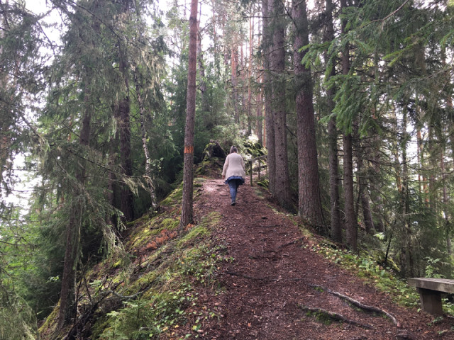
HD is walking up a steep-sided forested ridge, made up of silt and sand. When we got to the top, 50 meters above the river there was a closed off area with a sign: “Danger of collapse”. I was sceptical and edged around the barrier, to suddenly find myself perched at the top of a 50 metre vertical sand cliff. I retreated really quickly, without even pausing to take a photo!
These weird hills of sand are caused by a combination of ice-age deposition and land rise. As the Scandinavian ice cap melted huge rivers formed and deposited thick layers of sand and silt in the surrounding sea. Then the land rose, the coast retreated and the rivers cut down through the sand and silt. That meant rivers with high steep sandy banks. As the river meandered it changes course and cuts away a second bank, leaving these ridge-like hills.
For reasons I can’t quite understand, to do with pore size and capillary action the sand hills are stable, but they are easily eroded away if a flood, or people, cut away the base.
That’s the end of today’s geomorphology lesson!
Comments
Sign in or get an account to comment.


