You missed?
NO! U.M.I.S.T.!!
WAY back at the dawn of history I had a run up there with Bob Robbo R. I. P. on a Fire Safety inspection, of which I remember dammall.
I haven't the faintest idea if they are still there, but the aptly named UMIST was up there studying clouds.
What better location?
University of Manchester Institute of Science & Technology.
* ~ * ~ * ~ * ~ * ~ * ~ *~ * ~ * ~ * ~ * ~ * ~ * ~ * ~ * ~ * ~ * ~ *
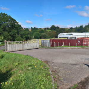
The real purpose of my jaunt was, in fact, to visit the now extinct Hazeldene Garden Centre. I knew it was on the cards, but not when.
Last time I contacted them, just in case before I drove out there, I learnt they'd finally closed.
This is the first of a series of irregular updates.
All that has happened thus far - Signs are gone, gate's closed = first time I recall even seeing Gates, and the once Car Park is now full of what appear to be Wagon Container "Offices"/Stores. There were a couple of swallows on the line - BUT - since they were unrecognisable and the lines NOT very photogenic I erased them.
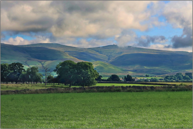
On "The golf ball" search - I saw this write up one one of the items.
"The radar station at the summit of Great Dun Fell is a key part of the national air traffic control system for northern England and southern Scotland. It was constructed in 1948 and the Civil Aviation Authority continued Gordon Manley's tradition of taking weather observations. The 'golf ball' radome was added in the mid 1980s."
I clicked onto it and there was NOT A WORD from that write up insight; the nearest it got to mentioning it was the wording of Dun Fell in it somewhere.
"This walk follows the Pennine Way to the summit of Great Dun Fell, the second-highest hill in the Pennines. It tells the story of the Gordon Manley, the geographer who pioneered the collection of meteorological data."
Comments
Sign in or get an account to comment.


