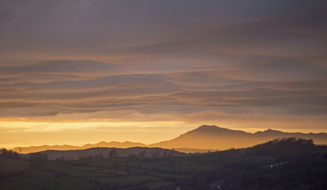
View north
In the late afternoon from home there appeared to be a layer of cloud across the whole sky. However, when I climbed the Knott, there was a gap in the cloud on the western horizon and light was streaming through this and illuminating Caw and the Coniston range to its east, and lighting up the cloud layer from below. This view is north from Arnside Knott into the Lake District, with the low fells in the foreground. On the lower right of this photo is the Lindale bypass, the road to Furness and Barrow.
From here Caw could almost be taken for an active volcano. I should know what the serrated ridge is to the left, perhaps someone on here could enlighten me. If not, I shall work it out from the maps, and update this page later.
I've had a better day today, I'm feeling a lot calmer and less distracted. C's relaxation class last night was very helpful in that respect, even if I did fall asleep.
Comments
Sign in or get an account to comment.


