
Up above the clouds
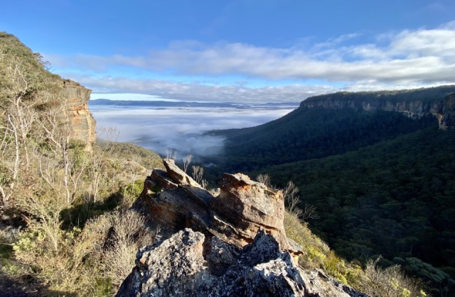
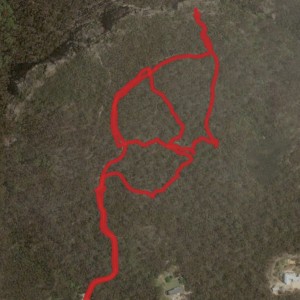
I headed out early this morning to walk the new tracks that we have been putting in at Wombat Hollow. The property is approximately 38 acres and most of it has been inaccessible up until now. I have added an extra of a screen shot from “Map my Walk”. It’s an App that through GPS allows you to see exactly where you’ve been walking and this is the satellite view of Wombat Hollow. The new tracks criss cross through the centre of the land and the vegetation is quite different in parts. The Banksias we discovered yesterday are quite huge and I would love to know how old they are. I do believe they are a very very slow growing species. I decided to venture down to Wombat Rock and what a bonus awaited. The entire Kanimbla Valley was covered in cloud and I was many feet above it taking this image. I’ve decided to teach myself how to turn this image into a Triptych for our photo group challenge. I think it lends itself to that process.
The important thing for us to do now is to walk the new tracks regularly so that they are well worn and we won’t get lost. In the meantime we have lots of surveyors ribbons hanging from strategic points. On my walk today I took some measurements as I reached different points and I have calculated that we have created over 800 metres of new tracks in the last couple of week. It’s been a huge effort but a very rewarding one to say the least.
Comments
Sign in or get an account to comment.


