
Aerial Survey
I’ve worked in local government since 1978 and as with all things technology has moved on in leaps and bounds during those more than 40 years. I can remember working for North Warwickshire Council in the early 1980s and we bought a sound level meter for noise surveys. It weighed 10 kgs and was about the size of a small suitcase. The latest meters will fit in your pocket and have more functionality.
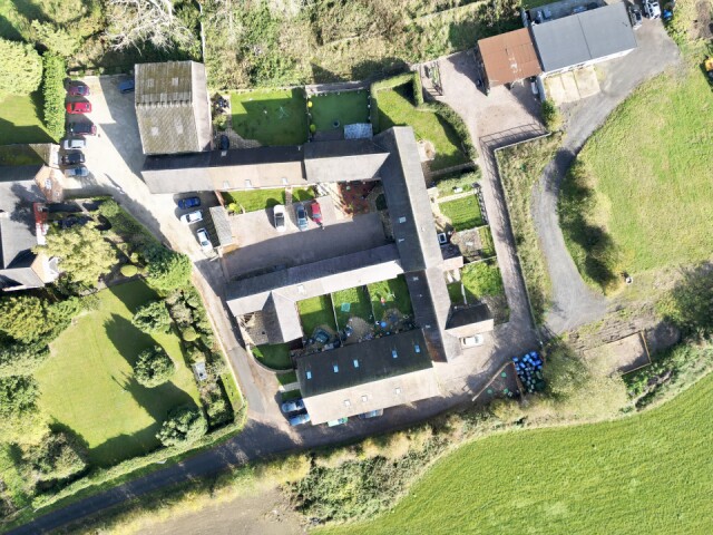
Aerial surveys were undertaken once every 10 years by aeroplane up until the early 2000s, before Google Maps provided satellite imagery via the internet. Today I was investigating a drainage problem at this group of barn conversions and I went one better by putting up my drone to capture images to more easily identify the manhole covers in the gardens and driveways.
Frustratingly, despite the development of new technologies we still need experienced people to interpret the data collected and they are often the first to go when ‘efficiency savings’ are needed. Let’s hope that we won’t be required to do this again. We’ve already seen an almost halving in the number of staff since austerity started in 2010.
Comments
Sign in or get an account to comment.


