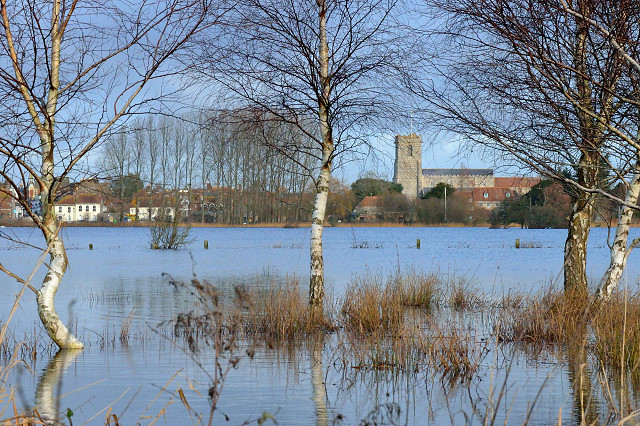
Wareham, viewed from Stoborough
Stoborough is at least a third of a mile south of Wareham. This photo was taken from the car park of the Kings Arms in Stoborough, which was only a few inches above the water level.
To the right you can see Lady St Mary church, to the left of center is Wareham Quay, and further left (viewing the larger version of the photo) you should be able to see the bright traffic and pedestrian lights of South Street.
The causeway between Wareham and Stoborough was flooded yesterday and this morning; and, but for the ring road, Purbeck would have been cut off from the rest of the world. (Yes, Purbeck proper begins south of the river Frome.)
The Frome came over its banks at the quay in Wareham, but what you see here is not the the Frome at all. It is the fields south of the Frome, soaking up the flood water. Always a spectacular sight.
I haven't heard whether any buildings in Wareham were damaged, but it is likely that some low lying Stoborough houses will have been flooded.
The map location indicates the position from which the photo was taken.
Comments
Sign in or get an account to comment.


