
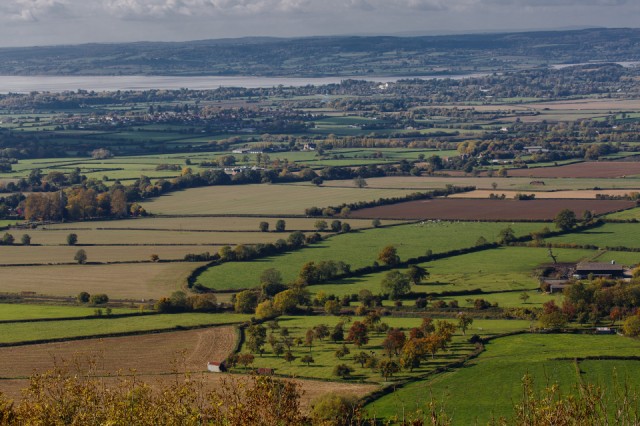
Across the Severn Vale from Haresfield Beacon
I knew that today's fine weather wasn't expected to last, so I drove west and ambled along country roads. Once I reached Standish I thought that being high up might be a good place to see the scenery, so I took a turning onto a tiny old drove road which ascended the steep escarpment of the Cotswold hills up to Haresfield Beacon.
The Beacons are a series of hill forts built on key promontories along the escarpment that marks the eastern edge of the valley formed by the River Severn as it approaches the sea south of Gloucester. I parked beside the track and walked back the few hundred yards to the Beacon through the land maintained by the National Trust who do a great job of caring for the sites.
There were several other walkers as well as stray cows mooing for the rest of the herd which they seemed to have lost. Crows and jays flew about over the dense woodlands lying just below the top of the escarpment. In the far distant south I could see the tall supports of the M4 bridges over the River Severn near Chepstow, which musty be forty miles away.
I stood for ages just looking out over the vale and trying to work out the various places I knew. One of them is the Wildlife and Wetland centre at Slimbridge, which is sited beside the tidal estuary in the distance. On the right of the picture in the middle distance is a large brown field which is of some interest. A couple of years ago I watched a tv programme about archaeology from a series called 'Time Team', which each week featured a three day investigative dig at a different site which was rumoured to have some merit. (Hopefully you can NOW watch that particular programme about Standish via THIS web link!)
The large brown field revealed its past history as a small but important middle Iron Age site, which the Romans settled on just a few miles from their fortress at Gloucester, and then it became a Saxon settlement after the Romans left. Then it just disappeared. Standish church lies about half a mile to the south of it in a wooded area, but the rest is just farmland.
Another field that interests me is the one at the bottom of the picture. It has a meandering hedge which indicates antiquity, and has a mixture of trees, some fruit bearing in an orchard pattern, but not all. Animals are grazing and you can see the 'ridge and furrow' markings in the field which indicate its medieval origins that have remained intact.
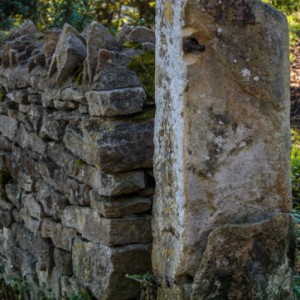
I think the study of landscape history is fascinating and am always on the look out for details in the existing landscape which can indicate so much about the past. My 'Extra photo' is of the old stone marking the gateway to the site which I also liked.
Comments
Sign in or get an account to comment.


