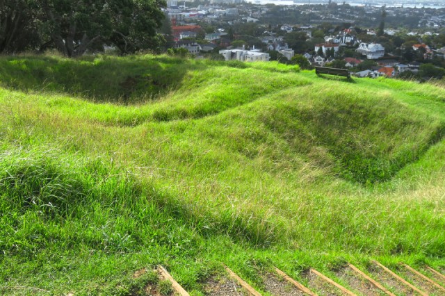
Kumara storage pits
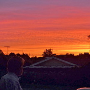
Left work early today to take S to an appointment for investigations (all turned out negative). Left her in their tender care and walked to Ohinerangi (Mount Hobson). It is quite a steep climb to get to the top; not very high (143m above sea level). Excellent views from the top. Of other volcanic cones, and the Orakei Basin (the water filled remains of another volcano). The city spreads out below and around.
I had not been at the top long when an Englishman, similar in age to me, arrived at the top. Obviously a tourist, from his conversation, and wanting to collect and know the facts. Was Rangitori the active volcano? I explained that while Rangitoto is the most recent volcano in the Auckland field, the nearest active volcano is White Island in the Bay of Plenty, a long way south. He was taken with the fact that there are 40 volcanoes in the Auckland field. In discussion I commented that there are a number of non-cone volcanoes and the total number of volcanoes is at least 50. I showed him Orakei Basin, and we talked about tuff rings and caldera.
We went our separate ways and I took this photo of two moderately large kumara storage pits. A brief discussion of these pits can be read here. I was pleased to see these and showing out so well with the sun lower in the sky. When I got up to the trig station at the top of Ohinerangi, he was sitting there looking at his pamphlets and having taken his photos. He asked for confirmation of his identification of Mt St John, and One Tree Hill (Maungakiekie). He then asked me to clarify which is the higher; One Tree Hill (no longer with a tree on the summit) or Mt Eden (Maungawhau) as he had two contradictory sets of information. Interestingly both gave the right height for Maungawhau (196 m). However, while the pamphlets gave him the height for Maungakiekie that I know (183m), he told me that a website lists it as 213 m high. Checking again tonight, the website is wrong.
Comments
Sign in or get an account to comment.


