
Traffic on the Gloucester to Sharpness canal
I suddenly decided I needed to get out and get a bit of exercise. Helena had already gone to meet a friend in town so I ventured towards the River Severn, where I knew I could be in relatively wide open spaces. In my short tour I also took in a visit to the roadside shed where Jess's Ladies Milk is available direct from the farm.
On the way back I went to the river bank at Epney and watched the rather overcast view towards the Forest of Dean. In the far distance to the north-west the peaks of the Malvern Hills, which are thought to resemble a serpent's back, stood out with a covering of snow.
I then took a different crossing of the Gloucester to Sharpness canal at Saul Junction, where there is a small side basin for mostly narrowboats to be moored, some of them residential. The junction is where the Thames and Severn Canal, which is gradually being revitalised, will rejoin the network in a couple of years and link up to Stroud and eventually beyond.
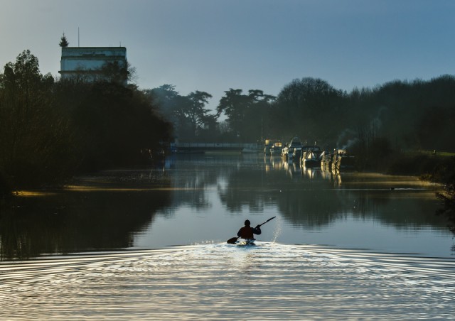
From the swing-bridge I watched the sky slightly as the sun began to break through the thick cloud cover. This canoeist is heading south towards Sharpness but I don't think he will reach it before the sun sets. I don't think the moorings on the right are residential, more likely they are for boats visiting the area. It was very busy even today in mid-winter.
The canal is so big because it was built to accommodate ships going to the inland port of Gloucester. To do that they leave the Bristol Channel through the very large dock gates at Sharpness, and then head north paralleling the River Severn as far as the docks at Gloucester. From there the canal rejoins the still tidal River Severn, which was canalised, so that smaller boats can head upstream to Worcester and beyond and join the extensive national canal network which has various links to the river.
Comments
Sign in or get an account to comment.


