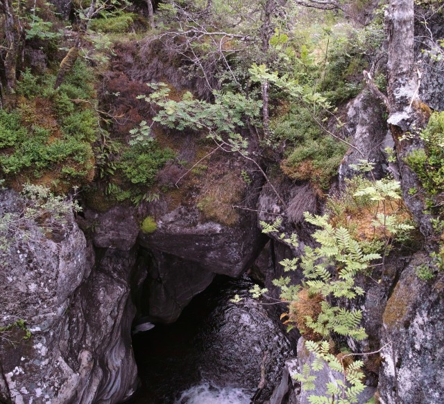
Natural Bridge over Burn of Agie
As I type I haven't decided what picture to post.
Tonight I drove to the end of the public road at Glen Roy. It even takes a long time in the car so my cycling time yesterday can be excused. I decided Caley might like a wee walk to the natural bridge which spans the Burn of Agie. This mountain stream is a major tributary of the upper reach of the River Roy and rises in the huge wilderness area to the north of Creag Meagaidh. I only know of the bridge's existence because it is marked on the OS 1 to 50,000 Landranger map and tonight was my first ever visit. I have only seen one other; on a hill burn on the south side of Loch Awe.
The approach was a little awkward. To make best use of established tracks I continued up Glen Roy on the wrong side of the river and had to cross on stones just above the confluence of the Roy and Agie. At first glance it doesn't look possible and upon crossing you need to climb out of a little gorge where the Agie tumbles down in a series of falls. Beyond this the burn is flat and meanders on a fluvial plateau. (That's my term but anyone who has seen this glen knows what I mean). Beyond this the Agie is in a steep sided and very deep gorge lined with birch, alder and mountain ash. You traverse the top of the gorge and the bridge comes in to view. A boulder of maybe a 100 tons is wedged in to the gorge and the water cascades below it. The trees overhang the gorge and approaching the edge up steam or down stream, to get a better view, is distinctly un-nerving.
I have never used my tripod like this. I extended it full length with the legs still together and mounted the compact camera. I set the timer hung on to a tree and extended the tripod horizontally in to fresh air above the gorge and hoped that it was pointing in the right direction.
Unless you know what the subject is I doubt the viewer would recognise the scene. (I will go with it but the walk presented lots of nice waterfall shots too)
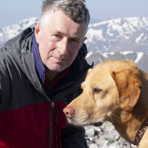
If you are worried about Caley in this environment he is extremely cautious on steep ground or close to cliff tops.
Hopefully you can make out the vegetation covered boulder which forms the bridge and the surrounding trees offer some scale. It is impressive and worth the effort getting here. The Glen Roy landscape is constantly changing and who knows how long the bridge will last. It might be gone in a thousand years!
(Which coincidentally was how long this blip took to upload)
Comments
Sign in or get an account to comment.


