
Ways of travelling
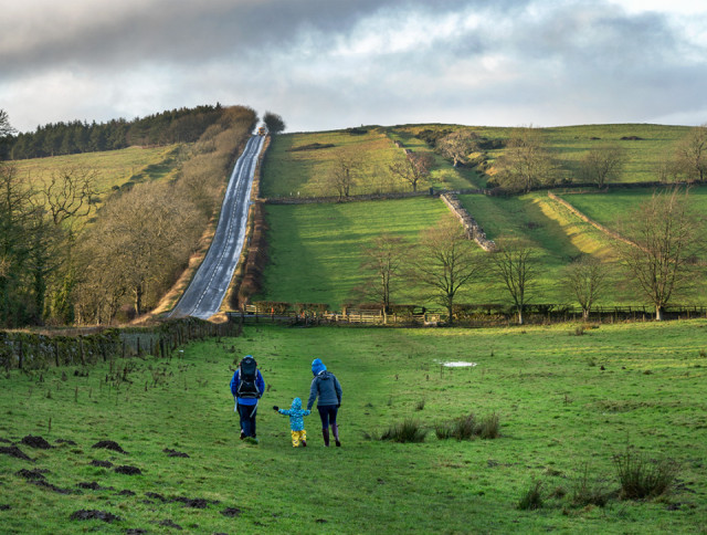
On the left of my picture you can see The Military Road (B6318) which is built on the route of General Wade's earlier road. His road was built in 1746 when he needed to move troops from Newcastle to Cumbria, in order to suppress the Jacobite rising. Wade was a great one for building roads.
In this case he did a lot of damage to the pre-existing Hadrian's Wall. You can see a section of the wall with Black Carts turret, on the right of the image, with the ditch to the north. The Vallum is to the north and is full of trees at this point.
In the centre is a small family negotiating the very muddy path. I like the way the toddler reaches out to hold his father's hand as well as his mother's.
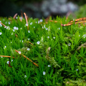
I took my car part way up to the trail today, to avoid the climb. It was very muddy and walking was hard going. I enjoyed the sudden mini-storm that blew up. The tiny hard pieces of snow formed jewels on the mosses and lichens as they melted. See extra.
The forecast was for good weather this morning, but it rained when I was ready to go for a walk. Instead, I made a spicy parsnip soup and a turkey and vegetable soup, using the turkey stock for both. The house smells wonderful. (Add to that the smoked haddock I cooked this evening and I suspect no one would want to visit for a few hours!)
Mum had yet another nose bleed today. As she grabbed a hankie, her iPad slipped off her knee and caught her left leg. The result was a nasty gash with a flap of skin to be dealt with. This time I had my coat on, but it was quickly removed as I jumped into medic mode!! I have made her sit with her legs up all day.....
PS I forgot to say that the trig point at Limestone Corner is visible on the skyline.
Comments
Sign in or get an account to comment.


